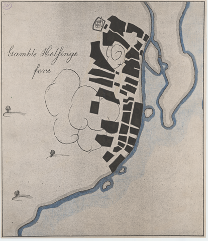
Partial view of an old map titled Gamble Helsinge Fors from 1640. The map depicts the area of the Old Town with block-per-block accuracy. The original map can be found in the Swedish State Archives in Stockholm, along with a copy in the Helsinki City Archives.