Helsinki logo History Helsinki
Select site language
Suomi Svenska English
Close Menu
Navigation menu
  • Phenomena
    Phenomena Toggle submenu: Phenomena
    • Events throughout the year
    • Constantly changing everyday life
    • Heading out to sea and into the wide world
  • Regions
    Regions Toggle submenu: Regions
    • Southern
  • Turning points
    Turning points Toggle submenu: Turning points
    • Origins and 16th century
    • 18th century
    • 19th century
    • 20th century
  • History on maps
Main navigation
  • Phenomena
    • Events throughout the year
    • Constantly changing everyday life
    • Heading out to sea and into the wide world
  • Regions
    • Southern
  • Turning points
    • Origins and 16th century
    • 18th century
    • 19th century
    • 20th century
  • History on maps

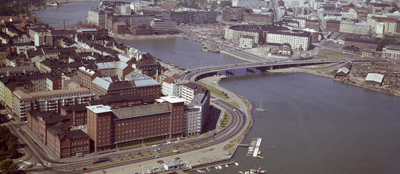
Kruununhaka ca 1865

Kruununhaka ca 1865
« Back to search results
« Back
Share icon Share
Share in Facebook Share in Linkedin Share in Twitter Send as an email
Kruununhaka, with Nikolainkatu (= Snellmaninkatu) 16–10 and 27–15 on the left. Number 8, formerly Nuuskamyllynmäki hill, can be seen on the front right. St Nicholas’s Church can be seen in the background. Low buildings, most of them wooden, and a cobbled street.
Location marker icon Show on map

Used in articles

An aerial view of Kruununhaka and the Siltavuorensalmi strait. The Hakaniemi bridge is in the middle of the image.

Kruununhaka – a city district of social strata

Article Article
Go to content

Photographer

Helsinki City Museum

Finna.fi record

(The link opens in a new tab.) Open in new window(Link leads to external service)

Formats

Photo Image

Copyrights

CC BY 4.0

Buildings

Helsinki City Museum
Helsinki logo
  • Give feedback(Link leads to external service)
  • Accessibility
  • Cookie settings
Back to top