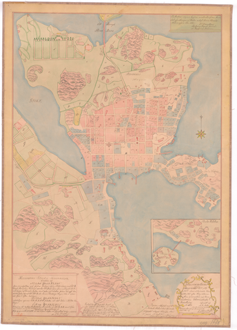
Topographic map from 1763 Topographic map from 1763 Share Helsinki depicted on a map from 1763. The rockiness of Kruununhaka stands out clearly. The western shore of Kluuvinlahti is still farmland. At the top of the map, in the middle, is the Pitkäsilta bridge. Show on map Used in articles A growing Helsinki, a changing environment Article Article Go to content Photographer Helsinki City Archives Phenomena Changing urban environment Period 1763 Formats Map Authors L. Fonséen Buildings Helsinki City Archives