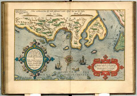
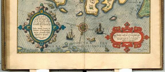
Tallinn Bay and the outermost coast of Finland as illustrated in the ‘Spieghel der Zeevaerdt’ (Mirror of the Seas) marine atlas from 1586 by the Dutch chief officer and cartographer Lucas Waghenaer. Waghenaer's atlas was the first of its kind and also depicted the Gulf of Finland as a separate entity for the first time. In Tallinn Bay a sea mark is visible; an anchored cone that served to warn of the Groote Caerl (Iso Karli) shallows located near the present-day Paljassaari island (nowadays a nature reserve). To the east of the bay are the islands of Wrangen (Prangli) and De Wolff (Aegna), with the island of Nargen (Naissaari) to the south. The Finnish archipelago, Finlandtsche Scheeren, was too scattered to be mapped. However, two islands (in a darker tone) are marked with a special ball sign used to denote an abundance of hardwood trees. One of them may represent the oak forests of Elisaari island in Inkoo. Ekeholmen (Mohni) on the Estonian side in the west is an equally well-known hardwood island, the name of which also refers to an oak tree. Oak was an important wood variety for shipbuilding.