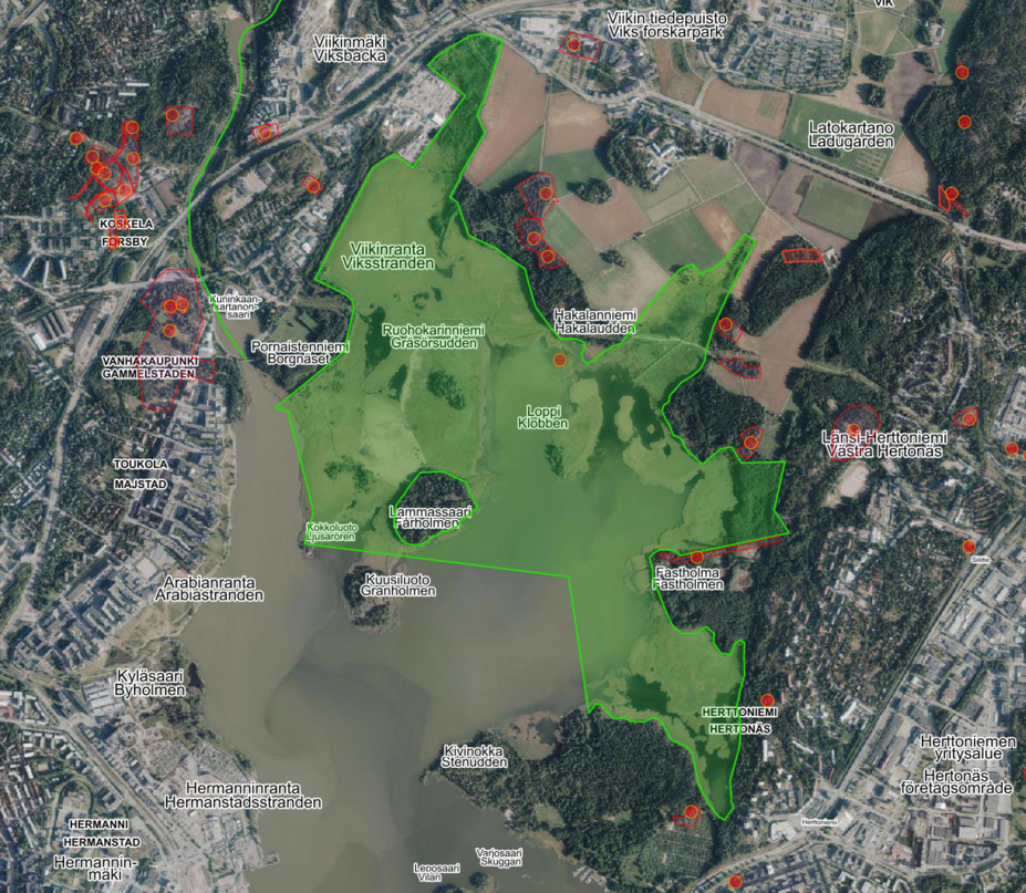
Vanhakaupunki
When Helsinki was founded in 1550 by King Gustav Vasa, the exact location of the new city was the subject of much deliberation. The choice fell on the mouth of the Vantaa River, on the land of the Koskela peasants. The king himself reportedly wanted to locate the new city on the island of Santahamina, but Erik Fleming, who was in charge of the arrangements for the new city, found the location to be inconvenient. Santahamina would have been a difficult place for the city in terms of defence and the transport of trade goods.
By contrast, Koskela and the mouth of the Vantaa River provided easier access to nearby towns and deeper inland, a more sheltered harbour and opportunities for expansion, unlike the island next to the open sea. The small island at the mouth of the Vantaa River was an excellent place to build a defence fortress typical of the period. The rapids provided energy and food – the waterways held plenty of fish, and the area is still a popular, if strictly regulated, fishing site.
The Vanhankaupunginlahti area has undergone major changes over the centuries. The area remains watery to this day, but back in the 19th century, the sea would rise in the bay all the way to Viikki Manor. No built environment has been preserved from the original old town. The area was built of wood, including the royal manor, and the oldest surviving buildings in the area are the water treatment plant and power station buildings from the 19th century on the island of the royal manor, now serving as the Museum of Technology. Today, the Vantaa River estuary and a large part of the Vanhankaupunginlahti bay west of the rapids are part of a nature reserve.
Relocation to Vironniemi
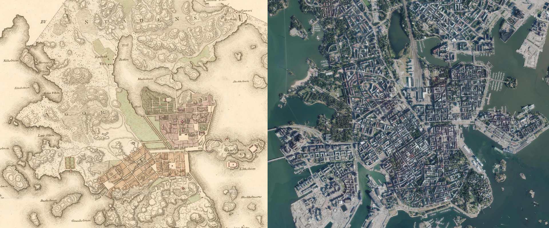
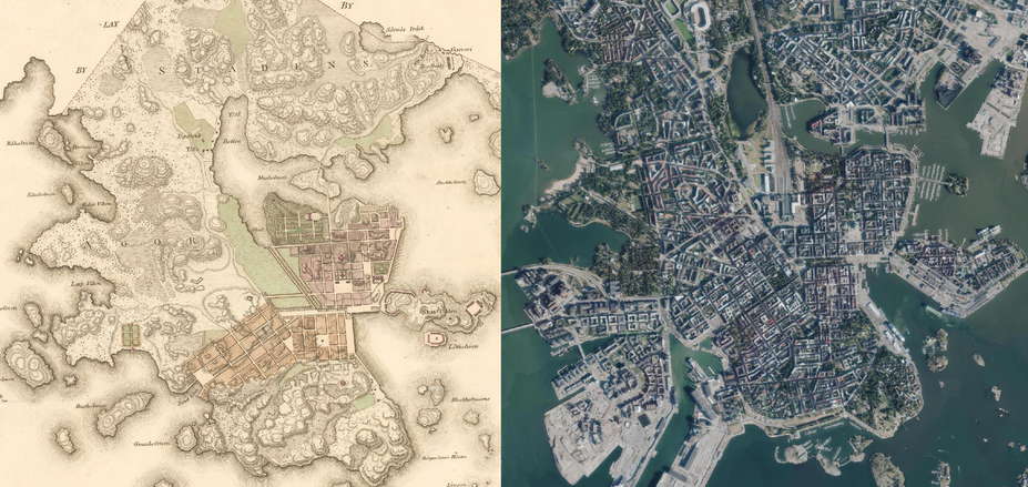
The move from Vanhankaupunginlahti to Vironniemi in 1640 was a decision of Queen Christina’s administration. The relocation was motivated by trade first and foremost: Land uplift had made the Vanhankaupunginlahti bay even shallower, while the size of merchant ships kept increasing. A place was being sought for the new port and city to accommodate both cargo and larger vessels carrying soldiers.
There was an alternative to the current location of the Helsinki city centre: the Sörnäinen peninsula. The area, currently known as the eastern inner city, was still part of the core of the new city in the plans made in the 17th century. However, construction in Sörnäinen was blocked by land ownership disputes and concerns that there would be no room for the city’s natural growth in the area.
When the town was transferred to Vironniemi, the already deserted village of Töölö, after which the current city district is named, was annexed to its land. Töölö represented a typical feature of Helsinki’s soil: a vast clay area. The clay soil met the needs of the growing city, providing raw materials for the manufacture of bricks. Helsinki is known for its rocks and cliffs in many places, but extensive areas with clay soil up to twenty metres deep are nearly as common.
Gradually, the new Helsinki became a densely built wooden city where the side effects of urbanisation and environmental problems also began to show. There was little waste disposal, so the city smelled constantly, the plot near the port was used as a landfill, and the waterfront was in poor condition. In spring, transporting goods was difficult, as paved roads were not built on a larger scale until the early 18th century, and spring thaws would make the roads extremely muddy. The district at the north-eastern edge of the city, inhabited by less well-off residents, was called the ‘Swamp’, which reflects the difficulties of settling the area. Helsinki was not only rocky in many places, but also watery.
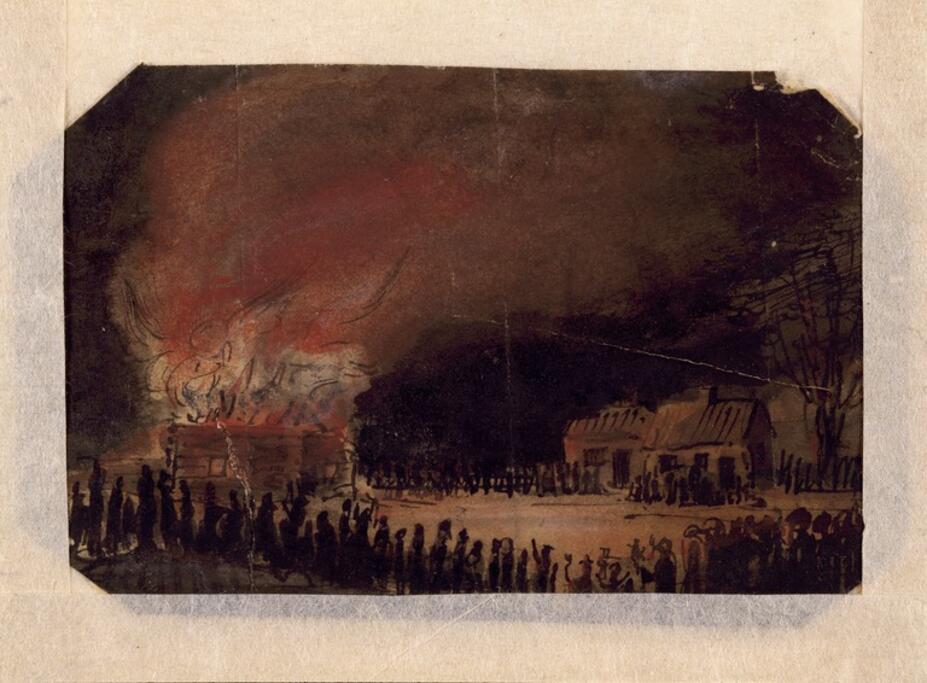
The densifying urban landscape of the new Helsinki was repeatedly shaped by fires. Helsinki, a city of wooden houses, had an enormous fire in 1654 that destroyed three quarters of the building stock. In 1713, during the Great Northern War, the Swedish army retreated as Russia attacked, burning Helsinki’s houses and bridges to the ground in their wake. During the Russian occupation, a Russian fortress and its service buildings were built on the site, but the actual reconstruction of the city only began once a peace treaty was concluded and the Russian army withdrew in 1721.
Sweden sought revenge on Russia with another war, but after that effort also ended in defeat, the strategy was changed and Sweden decided to rely on a large naval fortress, Viapori, the construction of which began in Helsinki in 1748. The original plan would have made the fortress both a sea and land fortress, making Helsinki a fortress city similar to today’s Hamina. However, insufficient funds forced Sweden to abandon its mainland fortification plans, but the huge Viapori construction project revitalised the economy and created busy transport operations between the city and the fortress. In the early 19th century, however, the city burned down again in the so-called Finnish War, and the new capital was planned and built almost from scratch.
A rocky capital city
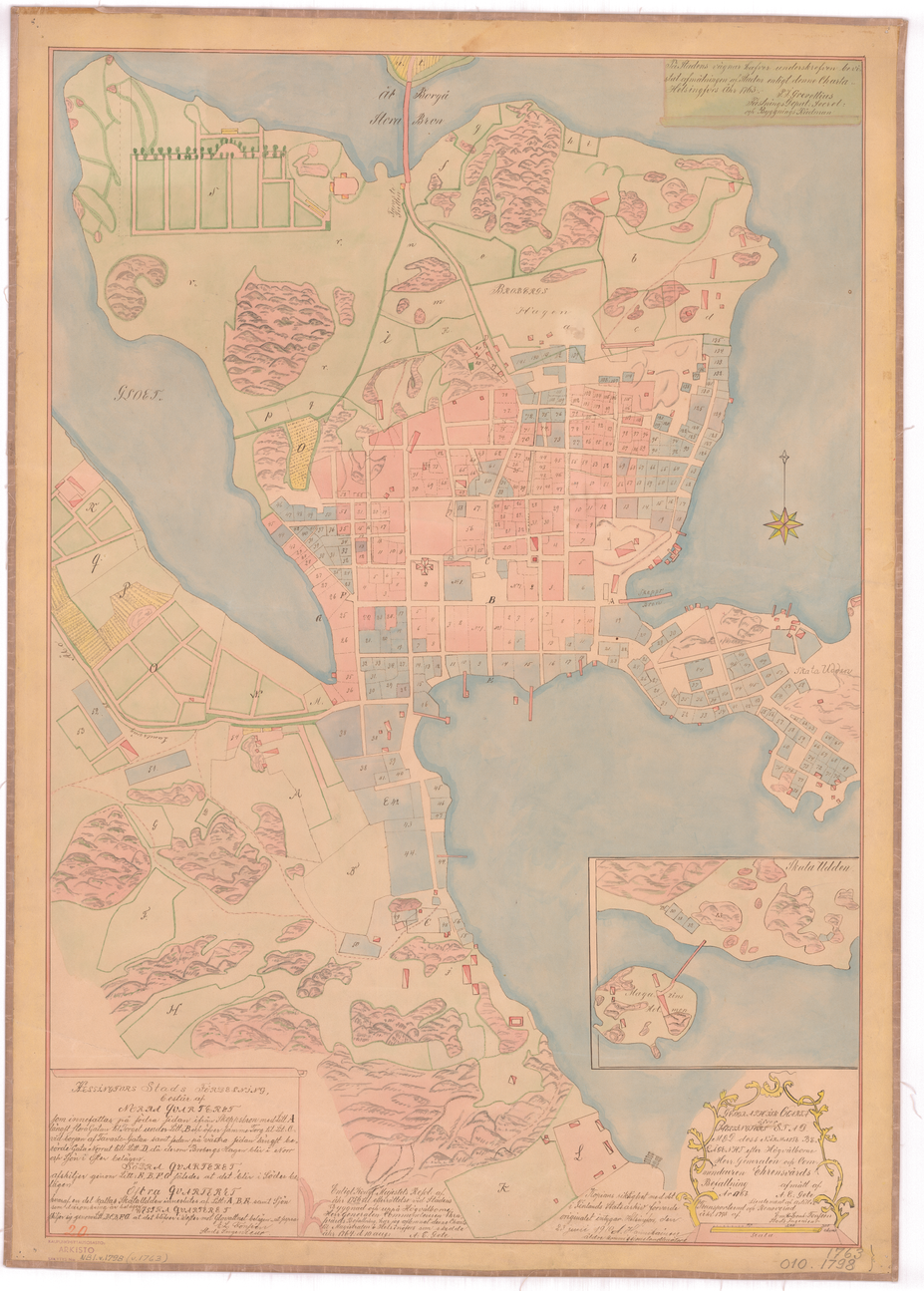
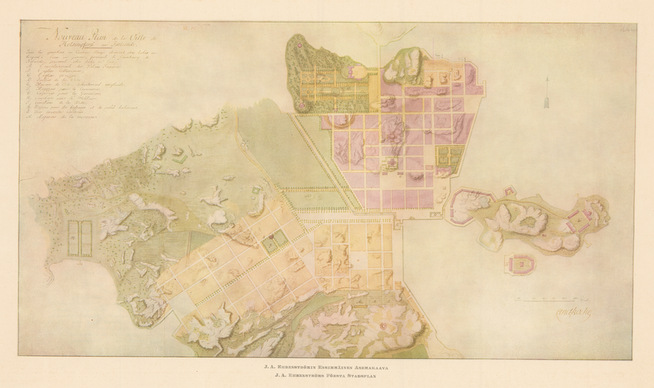
The plans and buildings for the new capital of the Grand Duchy of Finland, annexed by Russia, represent the oldest surviving piece of the old urban environment in Helsinki today. The influence of two people in particular can be seen to this day: J. A. Ehrenström, who was the chair of the City’s Reconstruction Committee, and Carl Ludvig Engel, who was hired by Ehrenström to serve as the Committee’s chief architect. Ehrenström drew the first detailed plans for the new capital, which served as the basis for the development of the city. In turn, Engel designed the city’s key buildings.
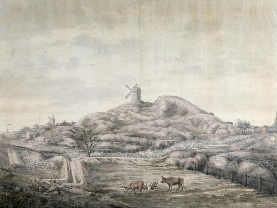
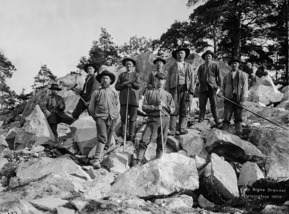
The new capital was to be built in the city planning spirit of the time as flat, rectangular blocks. However, the work proved difficult: the environment in which Engel’s creations were to be built was very hilly and rocky. Particularly in the area around the city centre, most of Helsinki’s land consists of bedrock left in place after the last Ice Age and now covered with a few metres of softer ground.
However, blasting the rocks was necessary: not only did it make room for new buildings, it also provided raw materials for building sturdy foundations and paving streets. Engel, who designed some of the most important buildings in the city centre, was reportedly so impressed by Helsinki’s granite landscape that he would have preferred not to touch some of the rocks at all. Instead of having the current huge monumental staircase in front of St Nicholas’ Church (now Helsinki Cathedral), his plans would have left much more bare bedrock in the surrounding area.
All of Finland is ... nothing but rock. Helsinki is located by the sea, but the whole terrain is rocky, and everywhere you build new roads you have to blow up mountains the size of a house.
Carl Ludvig Engel describing Helsinki in a letter to his parents in 1816
However, not all hills in the area could be levelled, and the topography of the area consequently steered the growth of the city: streets demarcating the cityscape and requiring even ground, such as the main street Henrikinkatu (now Mannerheimintie) leading to Esplanade Park and north, were drawn on more even areas. In some places, construction was also hampered by the fact that the rock bed was deeper underground than expected: Engel and his workers cursed the composition of the soil in the previously mentioned Swamp area, as the surface layers were softer than expected, and along streets such as Unioninkatu sections of the street gave way and sank into silt during the construction phase.
The hilly terrain of central Helsinki is still easy to see, e.g. by climbing on top of Tähtitorninmäki and looking along the so-called Union Axis towards Kallio Church. However, Helsinki’s highest point is man-made: the Malminkartanonhuippu peak, which rises to over 90 metres and is made of construction landfill.
At the height of its construction boom, imperial Helsinki was also quite grey and bare. New buildings were light or grey in colour. Over the years, the trees in and around the city centre had either burnt down or been felled for firewood and construction materials, and there were hardly any new parks built. For example, in the 1840s, there were hardly any trees taller than saplings in Kaivopuisto and Kaisaniemi.
Taming of water bodies
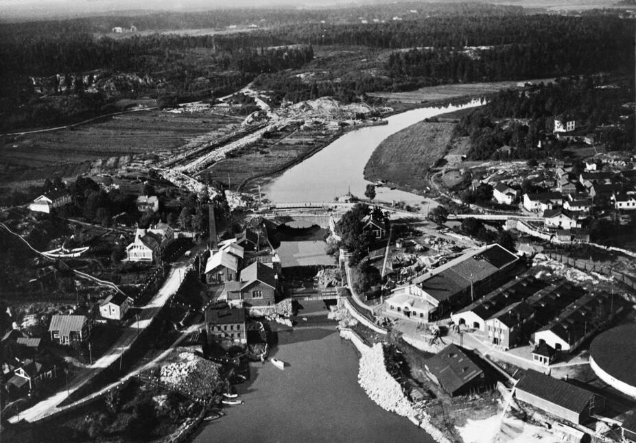
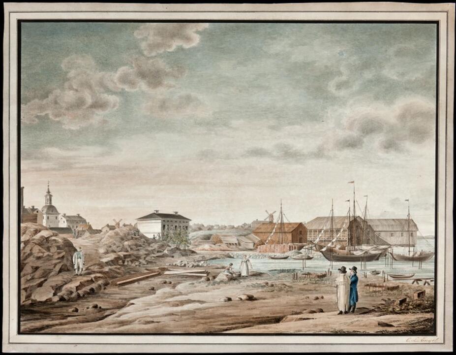
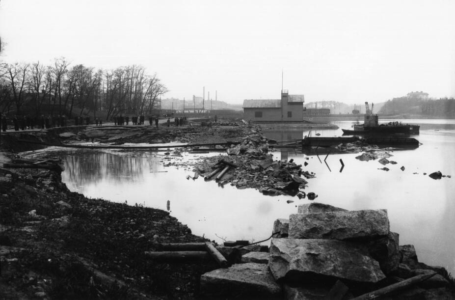
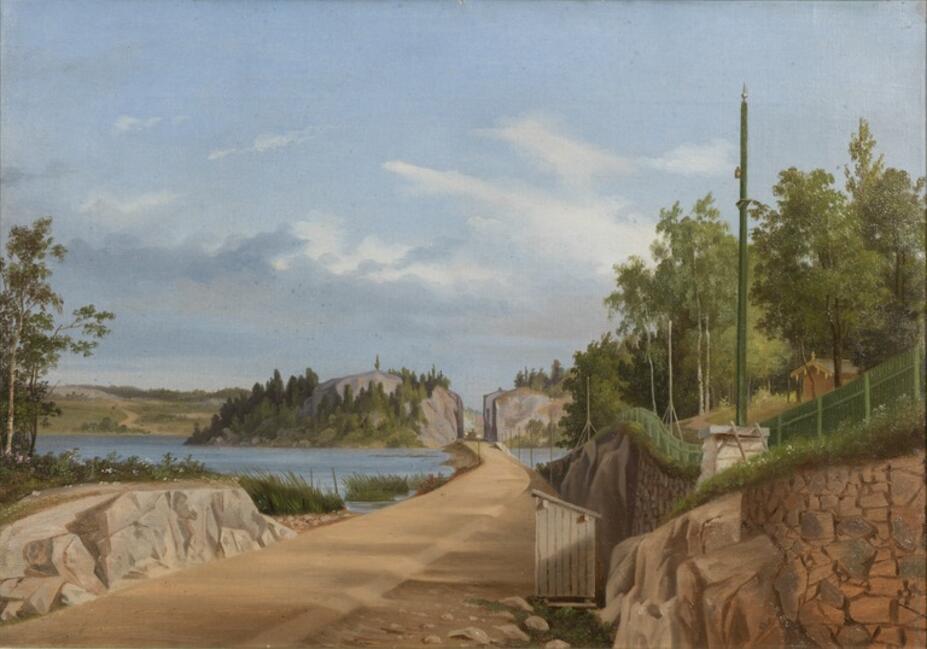
Cities have always grown along water bodies and waterways, and Helsinki is no exception. The Vantaa River, which flows through Helsinki into the sea, has been used as a fishing site and transport route, and efforts have been made to dam and harness the river as a source of power. The small island at the mouth of the river was also used as the building site of the royal manor. Over the centuries, both water mills and a hydroelectric power plant opened in 1872 have harnessed the Vanhankaupunginkoski rapids as a source of energy.
Unlike its surrounding municipalities, Helsinki no longer has a single body of water that can be classified as a lake. Back in the 19th century, there were three small lakes on the outskirts of the inner city: the lakes of Töölö, Huopalahti and Sörnäinen. All of them were filled in on land use grounds: the growing and densifying city did not want wasted space in such key locations ‒ the same procedure was also carried out in places such as Kluuvinlahti. Even in the past, the city’s plentiful swamps were mostly filled in and are now mainly referred to by place names: for example, the Ruskeasuo district is named after a swamp area that used to be located in the village of Pikku-Huopalahti.
Helsinki’s shoreline has evolved with construction as land has been filled in, the seafloor dredged and entire new city districts built on water. For example, back in the 19th century, the areas of the current districts of Jätkäsaari, Hernesaari and Sompasaari held nothing but the sea and islands. Siltasaari used to be an island, featuring a bridge past Siltavuori to Hakaniemi.
Today, the majority of Helsinki’s drinking water is obtained from Lake Päijänne instead of the city’s own groundwater. Opened in 1982, the 120-kilometre underground Päijänne Water Tunnel transports raw water to water treatment plants in the Helsinki Metropolitan Area – one of which is still in operation in the historic area of Vanhankaupunginkoski.
Railway across Helsinki
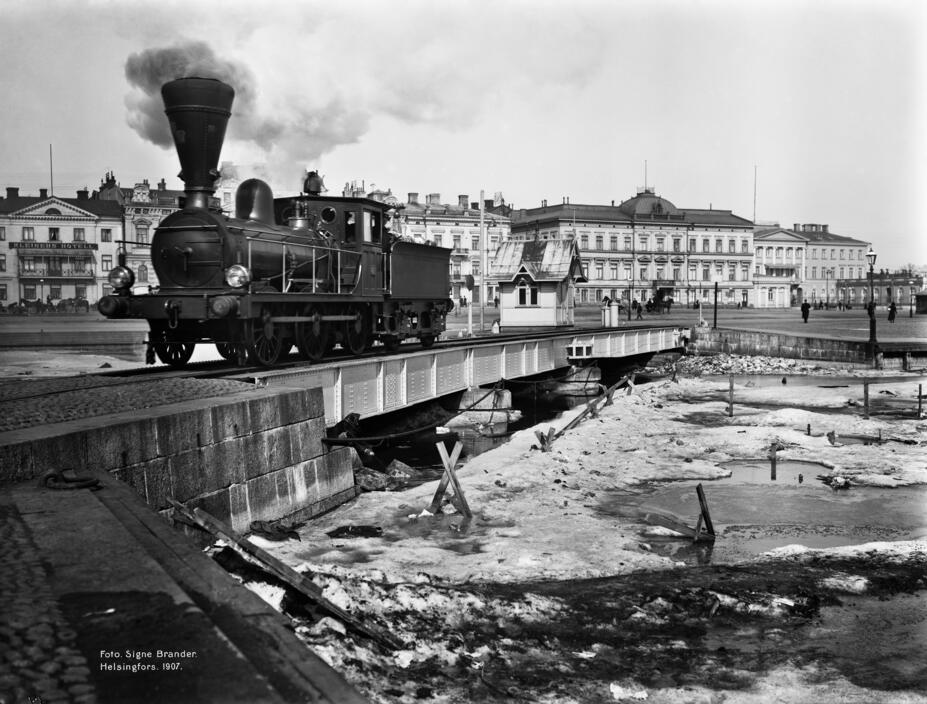
In accordance with Emperor Alexander II’s reform programme, railways began to be built in Finland after the middle of the 19th century. In particular, connections from the inland to seaports had to be developed, and the Helsinki–Hämeenlinna line, completed in 1862, was chosen as Finland’s first railway connection. The first wave of railway traffic already swept through the centre of Helsinki: The filling of Kluuvinlahti was accelerated, and Vironniemi was given its current shape that people have come to know. An embankment was built across Töölönlahti, and the rocks of Linnunlaulu were split to facilitate making the track as straight as possible. The location of the railway station also influenced the development of the city centre: as Kluuvi became a new transport hub, construction began to spread faster from the city centre towards Töölö.
Trains no longer run south of the main railway station, but in industrialising Helsinki, they played a major role. The railway was extended to go around the city’s shore, connecting its harbours to each other and to the mainland transport network. Busy (and noisy and smoky) train traffic was operated on Teollisuuskatu in Vallila and through Töölö well into the 20th century. Now, the only reminder of this in the cityscape is the Baana route, a non-motorised traffic route built into a former railway depression.
The construction of the railway in Helsinki has continued to influence the development of Helsinki to this day. Back in the 1850s, a couple of kilometres north of the train station, the current sites of Tripla and the nearby concrete office blocks featured only the small rural villages of Fredriksberg and Böhle. However, Pasila first became a rail yard area, then a densely populated suburb for workers and later an office district. As the rails branched further north into a main track and a shoreline track, construction along both accelerated, as the efficient transport connections provided by the railways increased the value of the land. The same development began on the east-west axis and continues to this day, with the construction of underground tracks and the inauguration of the Helsinki metro in 1982.
Outline of the city
Until the 1930s, Helsinki had grown mainly in the inner city by expanding its periphery, but after the wars, the need for new residential areas increased. The population grew rapidly, as a result of both rising birth rates and migration, and Helsinki began to develop suburban areas, or suburbs.
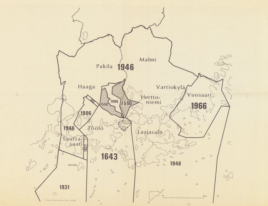
Helsinki’s regional growth and land acquisition had anticipated this development. The City had been preparing large-scale land deals for a long time, particularly under the leadership of Yrjö Harvia, a surveyor from the Ministry of Social Affairs. Helsinki’s land acquisition and expansion operations were steered by a variety of plans and indicators, such as population projections, economic and socio-political assessments, the needs of the future airport, the wishes of the residents of the surrounding municipalities regarding better governance, and efforts to curb so-called municipal tax havens. In the great annexation of 1946, Helsinki’s area increased fivefold and its population grew by more than 50,000 people, as large areas of the Helsinki rural municipality (now Vantaa) were annexed to Helsinki and the outline of the capital city began to resemble the outline that we know today.
At the beginning of the century, alternatives were also presented for Helsinki’s growth and development. In 1918, Eliel Saarinen(Link leads to external service) published his Greater Helsinki plan, which drew particular attention to the lack of space in the centre of Helsinki. In Saarinen’s vision, expansion to the north with a dense detailed plan was so important that Töölönlahti would have been filled in for construction and the new, as of yet unbuilt main railway station designed by Saarinen himself would have been moved to Pasila.